Big Creek near Alpharetta surged to 9.3 feet overnight Friday into Saturday, July 25, leaving large sections of the Big Creek Greenway under water and prompting the National Weather Service to extend its flood warning through Sunday afternoon, July 26.
The crest topped the creek's 7-foot flood stage by more than two feet and exceeded the 8.4-foot peak the NWS Peachtree City office had forecast Friday. It is the highest recorded level for Big Creek near Alpharetta since at least Jan. 20, 2001, when the creek crested at 8.4 feet, according to NWS flood history data.
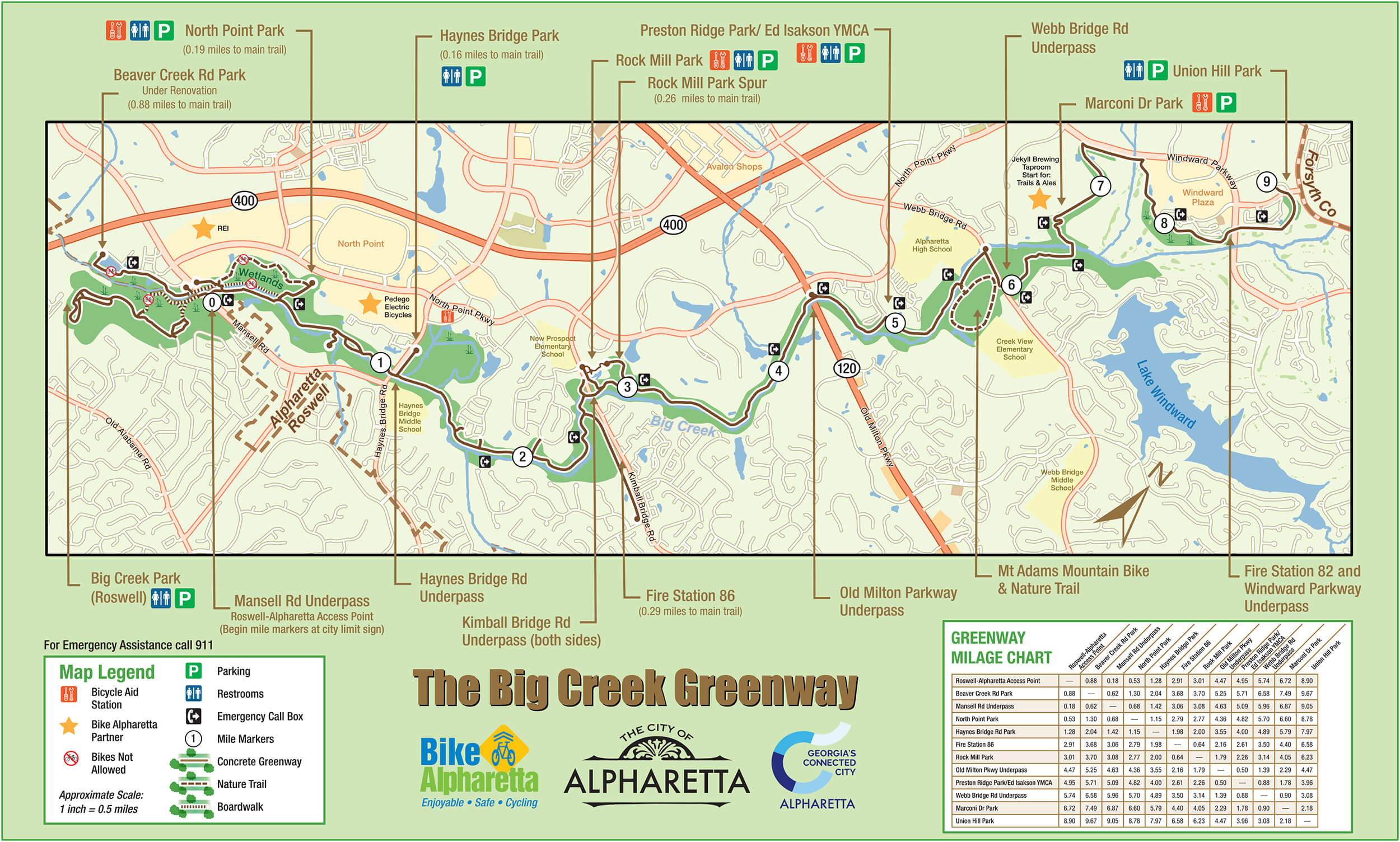
Stay off the Greenway. The NWS flood statement issued at 8:44 p.m. Saturday states that at 8 feet, most walking and biking paths on the Greenway are closed, with 1 to 2 feet of water covering the trail upstream and downstream of the gauge on Kimball Bridge Road and near Rock Mill Park. The North Atlanta Star reported water as deep as three feet in those areas at the 9.3-foot crest.
By 7:45 p.m. Saturday the creek had receded to 8.4 feet and was continuing to fall, according to the NWS. The agency forecasts Big Creek will drop below flood stage by Sunday afternoon and continue falling into Monday.
Other areas affected
Portions of the YMCA Campground off Preston Ridge Road are also expected to flood at the 8-foot level, according to the NWS statement. Low-lying yards near Seale Drive and Gunter Court may be affected as well, the North Atlanta Star reported.
Additional showers and thunderstorms were possible Saturday evening, which could slow the creek's recession.
Safety guidance
The NWS warns motorists not to drive around barricades or through flooded roadways and urges caution near riverbanks. The City of Alpharetta had not issued a formal Greenway closure order as of Saturday evening, but NWS flood-impact descriptions indicate the trail is impassable at current water levels.
The flood warning covers portions of Fulton and Forsyth counties. Residents can monitor creek levels and warning updates at weather.gov/ffc, the NWS Peachtree City office's website.
This stretch of the Greenway near Kimball Bridge Road and Rock Mill Park flooded under similar conditions in late May 2026, when the creek crested at 8.5 feet.